The Geological and Mining Institute of Spain (IGME-CSIC) It is the leading organization dedicated to the study of geology and natural resources in Spain. Its scientific and technical work in the Earth sciences makes it a national and international leader in the field. The information it provides on the subsurface, mineral deposits, and groundwater is essential for numerous sectors
In recent years, the construction industry has undergone a transformation driven by technological advances. One of the most promising and least visible—yet profoundly influential—areas is the geotechnology combined with smart sensors. These resources allow geotechnical engineers, architects and urban planners can work with a more precise understanding of the terrain, structural behavior, and environmental risks. But what exactly does this mean, and how is it being applied in practice?
What is geotechnology?
The geotechnology It encompasses a set of tools and techniques that enable the collection, analysis, and visualization of geographic and subsurface information. Among the most commonly used are geographic information systems (GIS), photogrammetry, terrestrial laser scanning (LiDAR), satellite remote sensing, and geophysical surveys.
In the context of construction, these smart sensors enable the identification of geotechnical risk zones to efficient land-use planning. For example, GIS systems allow users to integrate layers of information—such as slope, soil types, land use, and hydrological data—to select the most suitable sites for a construction project or to predict how the urban environment might evolve.
Smart sensors: Types and Applications
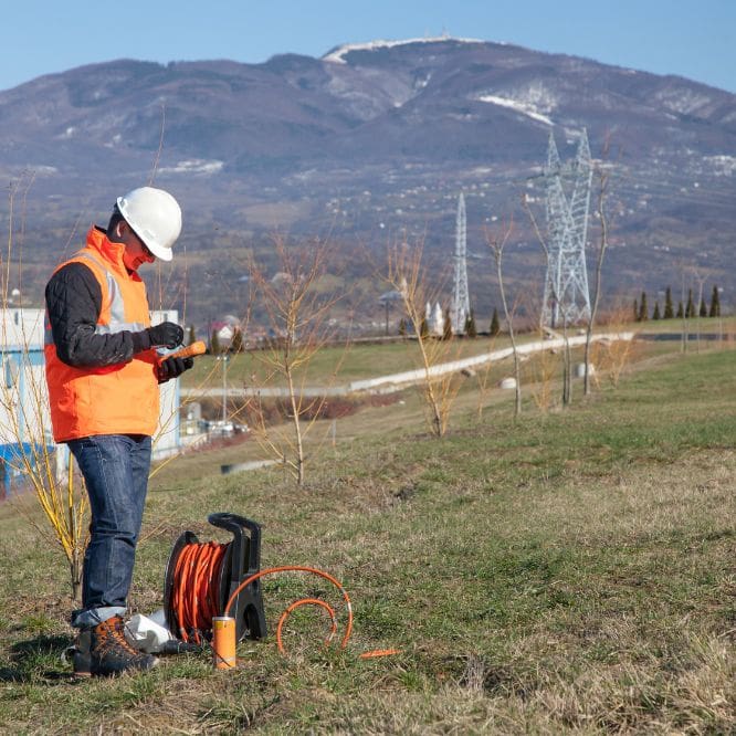
The inclusion of smart sensors In construction projects, these devices have radically changed the way safety, maintenance, and structural efficiency are managed. They collect real-time data on a wide variety of variables, including temperature, humidity, soil pressure, structural displacements, vibrations, inclinations, and groundwater levels, among others.
Among the most common sensors are the following:
- Strain gauges: used to monitor stresses in structures such as bridges or buildings.
- Inclinometers: which can detect ground movement or shifts in retaining walls.
- Piezometers: which measure water pressure in the ground, a key factor in foundation work or on unstable slopes.
- Wireless Geotechnical Sensors: that can be installed with minimal effort and transmit data remotely.
When these smart sensors They are integrated into an automated monitoring system, allowing for immediate decisions to be made in the face of potential risks, which not only saves time and money but can literally save lives.
Applications Real: From the Metro to Resilient Infrastructure Projects
One of the most notable applications of the combination of geotechnology y sensors smart It is in the construction of tunnels and large underground projects that it is crucial to know the composition of the subsoil with precision. For example, in the construction of a city’s subway system, the smart sensors It allows for real-time monitoring of ground stability, detecting potential subsidence or ground movement before they become serious problems.
Another increasingly common application is in climate-resilient infrastructure projects. Thanks to GIS and remote sensing, it is possible to model flood or landslide scenarios and make design decisions that reduce environmental impact or increase the durability of the structure.
In earthquake-prone areas, the smart sensors When installed on structures, they can detect unusual vibrations or damage accumulated from past events, helping to anticipate structural failures and optimize preventive maintenance efforts.
Key Benefits to integrate sensors and geotechnology
- Accuracy and foresight: Having accurate geotechnical data from the start helps avoid costly surprises during construction.
- Risk Reduction: Continuous monitoring allows for preventive action in the event of structural failures or geological problems.
- Financial savings: Although the initial investment may be higher, this is offset by shorter construction times, fewer design errors, and lower repair costs.
- Sustainability: It allows for the design of projects that are more environmentally friendly, avoiding unnecessary impacts or construction in fragile areas.
Challenges for the Future
Despite their benefits, the widespread implementation of these smart sensors It still faces challenges. Some of these include a lack of technical training, resistance to change from traditional players in the sector, and the initial investment, which may seem high for small or medium-sized projects.
However, the trend is clear: the digitization of the physical environment is now a necessity. More and more universities are including modules on geotechnology in fields such as civil engineering, architecture, and urban planning. In addition, the reduction in costs in smart sensors and real-time visualization systems are making their use increasingly accessible.
Conclusion
The synergy between geotechnology and smart sensors It is transforming the way we conceive and execute construction projects. This integration not only improves the accuracy of design and execution but also represents a significant step toward safer, more sustainable, and more resilient construction projects. In a world where urban and environmental challenges are becoming increasingly complex, having real-time data and detailed subsurface maps is not a luxury—it is a necessity.
If you found this information interesting, feel free to visit our Master's Degree in Continuing Education in Geotechnical Engineering and Foundations You'll find all this and much more.