Did you know that the sand on the beach you’re walking on today could be carried several kilometers away tomorrow? Of course you knew that, but… what factors cause this phenomenon, and how do they do it? Don’t miss this post on coastal dynamics! In it, we’ll answer these questions and show you how to calculate these sand movements, which are crucial in port construction projects.
The coastline, as we know it, is an extremely variable natural feature. About 20% of the Earth’s surface has been shaped by this dynamic action of the sea, a process that has taken millions of years. In general, the coastline is constantly evolving, driven in the short term by the relentless action of the waves and, in the longer term, by slow processes occurring on a geological scale.
By coastal dynamics This refers to the study of variations in sedimentology in coastal areas over time, as influenced by a number of external factors.
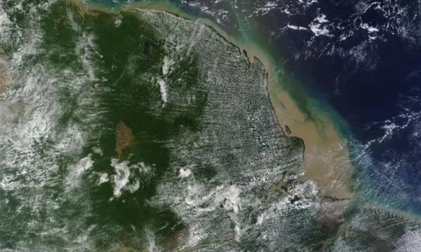
Sediment discharge from the Amazon River into the Atlantic Ocean.
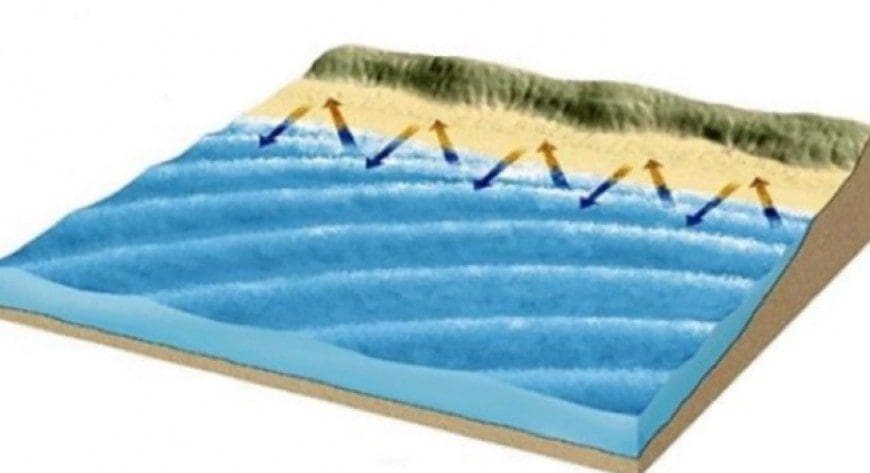
Thus, a stretch of beach is subject to coastal dynamics, such that each wave condition causes sediments to move from one place to another. Thus, when waves breaking at an angle to the shoreline transport sediment in the direction of the advancing wave fronts. As the water mass recedes after the waves break, this same sediment will flow down the line of maximum slope on the beach, causing it to zigzagging advance in a clear sense. Given this, it seems evident that the amount of sediment mobilized will depend on the wave energy (wave height).
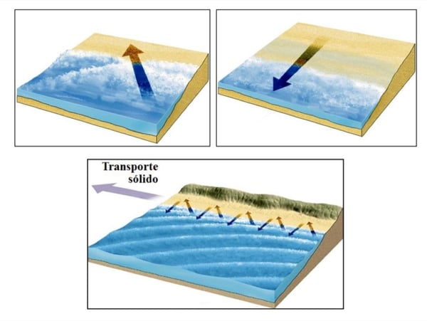
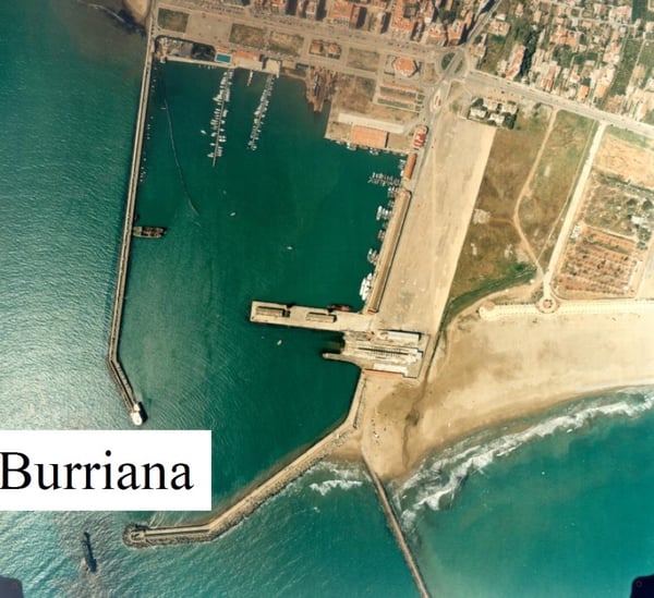
The condition of a stretch of coastline will be stable when the net solid transport, due to all the waves that have acted on that stretch of coastline, is zero. This equilibrium rarely occurs, except in very sheltered areas such as the bottom of coves or in areas well protected by natural or artificial obstacles such as a harbor, where We do not want there to be any sudden changes in draft and the geometry of the seafloor.
Thus, a major maritime project such as a port acts as a barrier to the natural transport of sand along the coast and must be studied in detail to ensure it does not interfere with the environment.
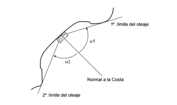
Let's now focus on quantifying sediment transport. Because the wave regime is varying in intensity and direction, the magnitude and direction of this transport also vary. Thus, an observer standing on the coast—depending on whether the waves strike on one side or the other of the normal to that coast—will see sediment transport directed in one direction or the other. Furthermore, the observed transport rate—measured in cubic meters of sediment per unit of time—will vary depending on the state of the waves. By integrating the transport measurements taken by the virtual observer over the course of a year, one would obtain a value for transport from right to left (Qdi), typically given in m3/year and, respectively, a value for left-to-right transport (Qid). Based on these measurements, the following concepts are defined: gross freight y net transportation.
Gross transport (which is always positive) is defined as:
Qb = |Qdi| + |Qid|
And net transport (with its sign, which indicates the direction of transport) is defined as:
Qb = Qdi – Qid
Since the latter—net transportation—is the responsible for sedimentation or erosion of the coastal section in question.
The most significant aspects of coastal dynamics occur in the surf zone, the area between the breakline and the shoreline, since that is where almost all of the energy carried by the waves is dissipated along the coast. As a result, the hydrodynamic flows generated and the transport values in this area are also the most significant.
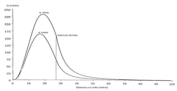
In addition to the concepts of gross and net transport already introduced, it is necessary to define those of carrying capacity y actual transportation.
Transport capacity is defined as the maximum amount of solid material transported parallel to the coast (gross or net) that can be achieved on a given beach, given specific wave conditions and sediment characteristics.
The most commonly used method for calculating transport capacity is the CERC (Coastal Engineering Research Center) formula, or «Energy Flow Method» (CERC, 1984) However, it has two drawbacks that must be taken into account: it does not account for sediment characteristics, and it was designed for beaches with a straight, parallel bathymetry.

Where:
- Q is the solid transport capacity, in meters3/year.
- Ho is the wave height at indefinite depths, in meters.
- θb is the angle between the wave crest at indefinite depths and the shoreline.
Finally, we'd like to highlight a short film taken from the AGI-EBF Basic Earth Science Series, written by Professors Douglas Inman and John S. Shelton, which perfectly explains the phenomenon we've been discussing today.
If you'd like to learn more about coastal dynamics, check out our master's program: