Drones have become the hottest technology of the moment—or at least, that's what the data shows: The State Aviation Safety Agency (AESA) There were 1,556 drone operators as of August 2016, while its latest report from December 2018 The total now stands at 3,623. This represents an increase of 2,067 specialists in a very short period of time.
The fact is, the versatility The features offered by these devices have expanded their uses to such an extent that they are now also present in various branches of engineering. In fact, as we will see throughout this post, their applications have their own specific classification:
Applications in the Visible Region
By using different types of sensors, we can observe reality beyond the visible spectrum that the human eye can perceive. However, in the case of drones, Its flight gives us unique views of the objects through high-quality photos and videos.
- Filming
Drones can access various types of infrastructure and buildings without putting operators' lives at risk, making these devices very useful for dangerous, time-consuming, and costly tasks. Some of these involve geological surveys, property registration, infrastructure assessments in high-risk situations, and other vertical construction projects.
- Photogrammetry
This is a technique that uses aerial photography to produce maps and plans of large areas of land. The main applications of photogrammetry include detailed digital elevation models and the production of orthophotos. Thus, among other functions, it is possible to virtual reconstruction of a dam o map the reservoirs.
Applications in Thermal Infrared
The aerial thermography It is a technique based on detecting the radiation emitted by objects and converting the data obtained into images that provide information about the temperature of the material. In this regard, the use of drones in this field has various applications:
- Building Efficiency
Thanks to the addition of a photogrammetric camera, drones can determine the insulating capacity of the materials, the quality of design and assembly of these, as well as the detection of thermal bridges and defects of the insulation.
- Solar Panel Inspection
The Identification of hot spots, also known as hotspots, is a drone's key function when it comes to detecting photovoltaic cells.
- Monitoring Water Stress in Plants
Water stress in crops causes the stomata to close, reducing transpiration and increasing leaf temperature. However, drones can monitor this rise in temperature by means of thermal sensors.
- Detection of Spontaneous Combustion
Similarly, monitoring using thermal imaging cameras installed on a drone makes it possible to monitoring the status of deposited materials. This is because the small amounts of metal sulfides contained in coal produce exothermic reactions.
- Locating Geothermal Anomalies
Furthermore, thermography also provides significant information in the field of geology: it identifies fractures, voids, and compositional differences in field stones; detects rock defects, etc.
- Inspection of Power Lines
Remotely piloted aircraft are responsible for carrying out Thorough inspections of power lines and substations electric companies such as preventive maintenance. This is because some of its components are located at great heights for safety reasons.
- Search and Rescue
The difference in temperature between people and animals and their surrounding environment makes it easier to locate them in large areas.
Applications in Reflected Infrared
Data collection in this spectral range provides relevant information on crop types, pests, plant growth, bodies of water, and mineral exploration.
- Applications in Agriculture
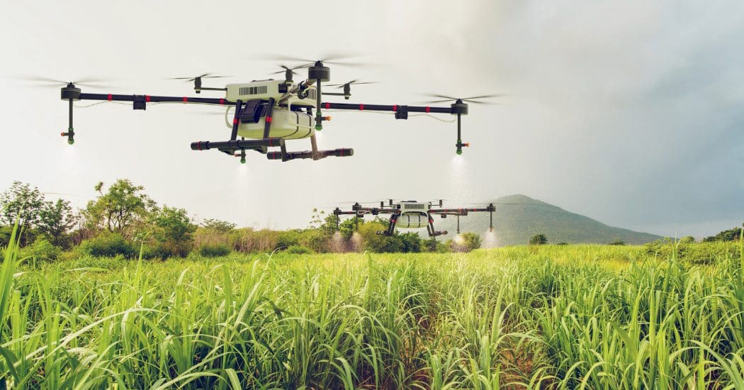
Precision agriculture is an agronomic concept that involves the differentiated management of crops based on an understanding of the variability present on a farm. In this context, unmanned aerial vehicles are already being used in Spain for various purposes: the detection of weed-infested areas, areas that need more or less irrigation o areas infested with fungi and other pests and the efficient water management, among others.
- Applications in Geology
The use of drones offers numerous advantages for gathering information on outcrops and for calculating and analyzing various parameters on the Earth's surface. Among these are the soil analysis, the detailed geological mapping, the risk analysis y land-use planning.
Li ApplicationsGIVE
This technology works by using a laser with different wavelengths to emit a beam of light that is reflected off the ground and received back by the airborne sensor. Therefore, the LiDAR point cloud allows for the creation of high-resolution digital elevation models based on elevations or waypoints.
This, in turn, allows us to use drones for topographic surveys:
- Topographic surveying in open-pit mining areas.
- Mapping of power lines, railroads, and pipelines.
- Monitoring of civil engineering projects.
- Mapping of corridors.
- Mapping of flood zones.
- Analysis of Natural Hazards.
As you can see, drones have a wide range of applications in engineering, and their uses continue to grow. What are you waiting for to become an expert at flying these devices?